How WW3 Could Start in the Strait of Hormuz
Published
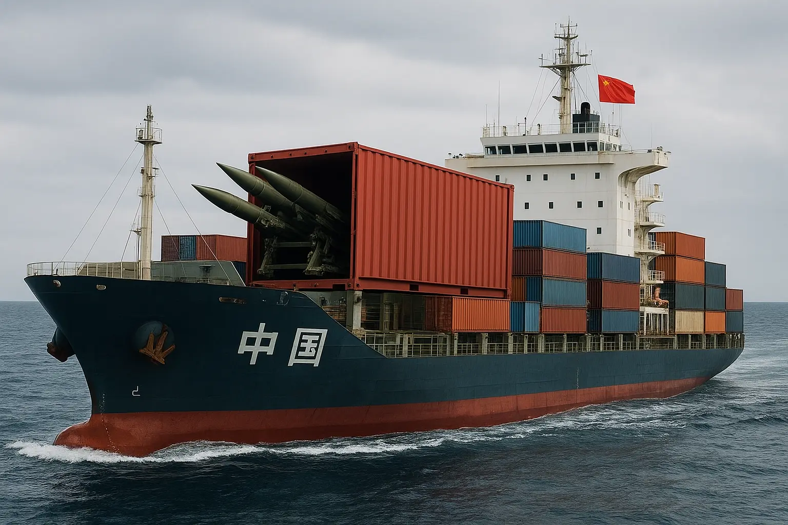
How WW3 Could Start in the Strait of Hormuz
A lot of WW3 scenarios people throw around are basically action-movie writing with maps. Hormuz is different. It worries me precisely because it’s not cinematic. It’s cramped, heavily watched, economically indispensable, and full of people operating under ugly time pressure.
The Strait of Hormuz moves roughly 20% of seaborne oil through a waterway narrow enough that there’s very little room for mistakes and even less room for graceful diplomacy. One misidentified ship, one unauthorized landing, one panicked weapons release, and suddenly Washington, Tehran, Beijing, and maybe Moscow are all making decisions off partial information. We’ve seen versions of the near-miss already: the USS Vincennes shootdown in 1988, the 2019 tanker seizures, the constant cat-and-mouse stuff between IRGC fast boats and U.S. warships.
The three cases that seem most plausible to me are not the flashiest ones. A U.S. landing on Kharg Island. A U.S. ship sinking what it thinks is a hostile merchant but is actually tied to China’s dual-use logistics network. Or an Israeli strike that hits a U.S. Navy vessel during operations against Iran. None of those require anybody to wake up wanting world war. They just require confusion, politics, and a few bad assumptions in a very crowded place.
I’ve spent years following naval escalation and maritime OSINT, and the main thing that cured me of overconfidence was getting burned by AIS data early on. AIS is useful. It is also incredibly easy to trust too much. Ships spoof it, shut it off, or just transmit nonsense. After missing a Gulf incident because I treated AIS like truth instead of one input, I got a lot more religious about layering sources.
The Strait’s Structural Problem: Geography Turns Incidents Into Shocks
The Strait of Hormuz is not just strategically important. It’s the kind of geography that takes a local incident and turns it into a market shock almost immediately.
Kharg Island is the obvious example. It’s Iran’s main crude export terminal, roughly 40 kilometers inside the Persian Gulf. Tanker routes run from Kharg toward the Strait through narrow shipping lanes, in places only about 10 nautical miles from Iranian territorial waters. If U.S. forces ever landed there, that would not feel like a tidy limited operation to Iran. It would look like a foreign military force standing on one of the regime’s most important economic organs.
The 2019 cycle is still the cleanest reminder of how brittle this all is. Between May and July, six tankers were attacked or seized. Iran’s IRGC detained the British-flagged Stena Impero. The U.S. shot down an Iranian drone. Insurance rates jumped about 30% in days. Some operators rerouted around the Cape of Good Hope, which added roughly two weeks and millions in fuel costs per voyage. Brent crude moved from about $60 to nearly $72 a barrel in a matter of weeks.
And the scale matters. Around 17 to 21 million barrels per day move through the Strait and nearby chokepoints. That’s about one-fifth of global seaborne oil. Even a short disruption, say 72 hours, can kick prices up sharply and set off downstream problems across energy markets. Europe and Asia have reserves, sure, but releasing them is never just a technocratic decision.
How to monitor the environment
If you’re watching this area seriously, start with AIS services like MarineTraffic or AISHub. They’re useful for vessel position, speed, route, declared cargo. But don’t marry the data. I made that mistake in 2017 when an IRGC vessel went dark during a harassment maneuver and I didn’t catch it until SAR imagery filled in the gap about 36 hours later.
So layer in Sentinel-1 SAR through ESA’s Copernicus program. SAR works through clouds and at night, and it can pick up metal hulls even when AIS is off. Depending on the mode, you’re looking at 5 to 40 meter resolution, which is enough to separate a tanker from a patrol boat.
For more frequent visual checks, Planet Labs is useful if you can justify the subscription. Daily revisits are enough to spot things like small-craft concentrations, changes in mooring patterns, odd activity around terminals.
I also like GDELT for signal detection. Not because media databases are magic, they aren’t, but because sudden spikes in terms like “Kharg,” “strait closure,” or “tanker detained” can show you when the information environment is heating up before the shooting starts.
A practical exercise that helps more than people expect: open Google Earth Pro and just measure the distances yourself. Kharg to the transit lanes. Missile range arcs. The spacing between lanes and Iranian territory. Once you do that, the whole place looks less like a shipping route and more like a tripwire.
Pro tip and common mistake
Pro tip: Use AIS, SAR, and human reporting together. Every stream lies in its own way. When they line up, confidence rises. When they don’t, that’s usually the real story.
Common mistake: Thinking only in terms of big platforms. In confined waters, small boats, mines, unmanned surface vessels, even a single disabled tanker can have outsized effects. Honestly, the obsession with sleek major-power naval hardware sometimes misses the point. In Hormuz, the annoying cheap stuff can be more dangerous than the impressive stuff.
Key Point: Geography amplifies friction. In the Strait, ambiguity plus proximity equals rapid escalation.
Scenario A: U.S. Boots on Kharg Island (Why “Limited” Operations Aren’t)
A U.S. landing on Kharg would immediately move the crisis from maritime pressure into something much closer to territorial occupation.
Say U.S. helicopters seize the oil loading terminals after an incident. Maybe the stated goal is rescue. Maybe it’s to deny Iran the ability to close the Strait. The word “temporary” would show up fast in official statements. Tehran probably wouldn’t care. Foreign troops on the country’s main oil export terminal would be read as a direct challenge to regime credibility and survival.
That’s the trap. If Iran absorbs it, it looks weak at home. If it pushes back, it risks a direct war with the U.S. There isn’t really a cheap off-ramp.
There’s precedent here. In April 1988, after the USS Samuel B. Roberts was damaged by a mine, the U.S. hit Iranian oil platforms. Iran responded by attacking neutral shipping and firing missiles into Kuwaiti waters. The spiral took days. A modern Kharg operation could move even faster because now satellite imagery, Telegram, and nonstop media coverage make quiet de-escalation much harder.
Signals to watch in the first 72 hours
If this happened, I’d watch a few things right away.
- IRGC fast-attack boat movements out of places like Bandar Abbas and Bushehr. Those departures matter fast.
- Coastal missile activity. Iran has multiple land-based anti-ship missile sites, and Sentinel-1 can sometimes show vehicle movement or launcher repositioning if you know where to look.
- Terminal shutdowns or tanker diversions. AIS tracks would show the rerouting pretty quickly, and Lloyd’s risk advisories would probably follow within hours.
- Narrative hardening in state media and IRGC-linked channels. This sounds soft compared to missile batteries, but it matters. Once the regime commits publicly to a line, backing down gets harder.
Tools and exact steps
For imagery, PlanetScope is useful over Kharg and nearby military sites. Sentinel-1 SAR from Sentinel Hub is the cheaper and often more practical baseline. Query the Gulf every 6 to 12 hours if the situation is live.
On vessel movements, MarineTraffic’s API is worth using if you have access. Set alerts for sudden slowdowns, loitering, or AIS blackouts. Those are not proof of anything by themselves, but they’re often where the trail starts.
The U.S. decision tree here is ugly:
- Stay and fortify. Which means more forces and a likely long crisis.
- Pull back. Which may be strategically smart and politically miserable.
- Try to negotiate while under fire. Possible, but not a comfortable bet.
None of these choices is clean. Occupation invites asymmetric responses: mines, proxy attacks in Iraq, Syria, or Lebanon, cyberattacks on U.S. and allied energy infrastructure.
Pro tip and common mistake
Pro tip: Watch Iranian domestic politics, not just military balance sheets. The IRGC’s institutional interests and the regime’s fear of looking weak may matter more than whatever a neat deterrence model says.
Common mistake: Assuming a show of force automatically restores deterrence. Sometimes it just creates more targets and more incentives for cost-imposing responses.
Key Point: Even a “limited” landing on Kharg would create escalation pressure very quickly. Boots change the whole argument.
Scenario B: A U.S. Ship Sinks a “Merchant” That’s Actually Chinese
This one scares me because it’s built on classification failure, and classification failure is common.
The classic case is the USS Vincennes. On July 3, 1988, it shot down Iran Air Flight 655, killing 290 civilians, after the crew misidentified the Airbus A300 as an attacking F-14. Time pressure, flawed IFF interpretation, bad assumptions. The political fallout lasted years.
Now translate that logic into the present. A U.S. destroyer operating under blockade or interdiction rules engages a ship it believes is supporting Iranian forces. It flies a Panamanian flag. The crew is Chinese. The vessel is sunk. Then Beijing produces evidence that it was carrying dual-use cargo under state charter and tied into China’s broader civilian-military fusion logistics system.
At that point the legal and political fight starts immediately. Was it a valid military target. A protected merchant. A ship doing intelligence support under commercial cover. None of those arguments stays technical for long.
China’s merchant fleet is huge, and documented state ties exist across parts of it. Reservist crewing, logistics contracting, dual-use charters. This is not hypothetical paperwork trivia.
What analysts need
You want time-stamped AIS tracks, SAR overlays, deck imagery, SIGINT if available, radio traffic, port call histories. No single stream settles identity on its own.
That’s the frustrating part. Better data helps, but it does not eliminate ambiguity. I might be wrong about this, but I think people still underestimate how often states preserve ambiguity on purpose because it’s useful. Plausible deniability is a feature, not a bug. The problem is that third parties then make kinetic decisions inside that fog.
Tools and monitoring stack
Use MarineTraffic for current and historical AIS if you have a paid tier. Sentinel-1 SAR is still the best free check on whether a ship is where it says it is. Planet Labs helps with visual confirmation of deck cargo and superstructure details. Then do the boring work: Lloyd’s List, port authority records, shipping databases, ownership shells, prior port calls.
A basic workflow looks like this. Pull SAR over the Persian Gulf through Sentinel Hub. Cross-match with AIS from AISHub or MarineTraffic. If AIS says the vessel is 50 kilometers from where SAR shows a hull, either the transponder is lying, you’re looking at a different ship, or somebody is trying to create confusion.
Example MarineTraffic API call:
curl "https://api.marinetraffic.com/api/exportvessel/v:8/?protocol=http&msgtype=extended&v=SHIP_ID×pan=48&key=YOUR_API_KEY"Replace SHIP_ID with the vessel’s MMSI and add your key. That gives you 48 hours of position reports, which you can compare against SAR detections.
Pro tip and common mistake
Pro tip: Before any kinetic action, demand layered attribution. Visual ID, AIS, SAR, HUMINT, SIGINT. It’s slower and less satisfying than people want in a crisis, but that’s the point.
Common mistake: Trusting a single source because it’s machine-generated and looks clean. AIS is the worst offender here. People see a tidy track on a screen and act like reality has signed off on it. It hasn’t.
Key Point: Identity uncertainty is an escalation multiplier. If the target might be Chinese, the burden of certainty has to be much higher.
Scenario C: An Ally Strikes U.S. Ships (Political Pressure Trumps Logic)
An attack by an ally is, politically, sometimes harder to manage than an attack by an adversary.
The historical anchor is the USS Liberty. On June 8, 1967, Israeli forces attacked the U.S. signals intelligence ship off Sinai, killing 34 and wounding 171. Israel said it was a mistake. The controversy never really went away, and the immediate fallout was brutal enough: hearings, public anger, alliance stress.
A modern version in the Gulf would be even nastier. Picture Israeli forces striking a U.S. destroyer during operations against Iranian targets. Maybe it’s a real identification error. Maybe it’s a reckless attempt to widen U.S. involvement. Either way, Washington has almost no comfortable option set.
De-escalate quietly and absorb domestic backlash. Punish Israel and risk a major alliance rupture. Escalate against Iran anyway and potentially widen the war on the back of a confused or manipulated incident.
What makes ally incidents different
Domestic politics more than military logic. Congress, media, lobbying networks, activist groups, election cycles. All of that compresses the timeline and makes visible action more attractive than patient attribution.
That’s one reason I’m pretty skeptical of chest-thumping crisis commentary on cable news. It rewards the worst instincts at exactly the wrong time.
Once casualty numbers hit the screen, the pressure to “respond” starts outrunning the pressure to “understand.”
Signals to watch
I’d watch the basics first: casualty counts, official statements from Washington and Jerusalem, timestamps of calls between defense ministries, whether Congress starts scheduling emergency hearings, and whether any radar logs, fragments, or communication intercepts get released.
The sequence matters. If public messaging hardens before forensic exchange begins, the political space for de-escalation shrinks fast.
Tools and steps
Use GDELT and Meltwater to track narrative acceleration in real time. For the U.S. political side, Congress.gov and GovTrack are enough to show whether hearings or emergency resolutions are already moving.
The real de-escalation tools are less glamorous: hotlines, pre-agreed investigative channels, neutral review panels, rapid exchange of radar data, weapon telemetry, communications metadata. If these procedures exist before an incident, they buy time. If they don’t, everyone starts improvising in public, which is usually bad.
Pro tip and common mistake
Pro tip: Pre-authorize forensic exchanges between allies. Radar logs, flight data, communication metadata. Make it automatic, not discretionary.
Common mistake: Treating alliance management as a purely strategic chess problem. It’s also emotional, public, and often humiliating for somebody. That part drives decision-making more than analysts like to admit.
Key Point: An ally striking U.S. forces creates a uniquely ugly mix of domestic outrage and alliance panic.
What You Can Do Right Now
Immediate action (for analysts, journalists, citizens)
Set up a simple layered watchlist.
- AIS alerts for the Strait through MarineTraffic or AISHub
- Sentinel Hub coverage for Sentinel-1 SAR over the Persian Gulf, roughly 26° to 27.5° N and 54° to 57° E
- GDELT or Google Alerts for terms like “Kharg,” “strait closure,” “tanker seized,” “IRGC vessel”
This is maybe an hour of work, and it gives you a much better starting point than waiting for headlines.
This week (for policymakers and think-tank analysts)
Run a 48-hour tabletop. Use one of these scenarios, or all three if you have the staff time. Make State, Defense, Intelligence, and Energy define their attribution thresholds, decision triggers, and public messaging timelines. Build in imagery injects from Planet or Sentinel. Force a rules-of-engagement discussion before the fictional crisis, not during it.
Long-term institutional change
The most useful structural fix would be some kind of multilateral Hormuz confidence mechanism. Not a grand peace architecture. Something more practical: a standing forensic exchange and rapid attribution body with neutral observers, AIS and SAR cross-check procedures, ordnance forensics, and maybe even an agreed 72-hour non-kinetic cooling-off period for disputed incidents.
Politically, that’s hard. Maybe unrealistically hard in the near term. But it addresses the actual problem, which is misattribution under time pressure.
Actionable takeaways:
- Combine AIS, SAR, and HUMINT before drawing strategic conclusions.
- Push for rapid forensic exchange channels with both allies and rivals.
- Treat “limited” moves like a Kharg landing as escalatory by default.
- Do not make kinetic decisions off single-source attribution.
What’s Next
The risk in Hormuz is probably rising, not falling. Sensors are better than they used to be, but political time compression, dual-use shipping, false flags, and deliberate ambiguity still make mistakes very possible. We’re likely to see more private-sector monitoring, more dependence on commercial AIS, more commercial SAR, and eventually more pressure for some neutral attribution mechanism.
If you want to go deeper, the useful sources are the usual serious ones: Jane’s Intelligence Review, IISS maritime reporting, CSIS and RAND work on Gulf naval operations, Sentinel Hub and Planet for imagery, MarineTraffic and AISHub for AIS.
A good place to start is simple. Pull Sentinel-1 SAR scenes over the Strait through Copernicus, compare them with AIS tracks, and look for mismatches. That exercise alone teaches you a lot about how messy maritime attribution really is.
The core question is still the uncomfortable one: when immediate attribution is the difference between a diplomatic fix and a military spiral, who gets trusted to make that call? States with obvious interests. Private firms selling the data. Or some independent multilateral body that everyone will complain about until the day they need it.
Worth sharing?
Send this to someone who would find it useful.